Nye County
Community Description & Overview
Nye County is the third largest county in the United States based on land area, and spans a total area of 18,193 square miles, with nearly 98% of the County’s total area managed by the federal government. Tonopah is the county seat. The 2010 U.S. Census estimated Nye County’s population to be 43,496, with about 2.4 people per square mile. The County’s population is heavily concentrated in Pahrump (36,583) with more than 80% of the residents living in the County’s largest and southern-most town. The five other most populous towns include: Tonopah (2,497), Round Mountain/Smoky Valley (1,577), Amargosa Valley (1,456), Beatty (1,032), and Gabbs (525).
For a significant portion of the County’s history, mining, agriculture, and government employment (both local and federal) have influenced the economic prosperity of the area. Mining, however, is cyclical and highly dependent on fluctuating market prices. Additionally, revenues associated with federal government employment and funding have seen a reduction in recent years due to federal opposition to the Yucca Mountain Project. These issues have led the County to pursue industries to diversify the local economy. Since 2007 Nye County has welcomed and worked with the renewable energy industry to streamline development for environmentally sustainable projects.
Nye County is provided power by three entities: Mt. Wheeler Power, Valley Electric Association (VEA), and NV Energy. Each power provider owns, maintains, and operates their individual infrastructures. Mt. Wheeler Power services Currant and other northeast Nye County communities. VEA services the southern Nye County communities of Pahrump, Crystal, Amargosa Valley, and Beatty. NV Energy services northwest, central, and a small portion of southeast Nye County, which includes the communities of Gabbs, Round Mountain, and Tonopah.
Renewable Energy Factors
With its abundant solar power potential, and available geothermal, wind, and biomass renewable energy resources, Nye County is well-suited for renewable energy projects.
The RDSBC Nye County, NV Renewable Energy Resources map (right) shows solar resources for Concentrating Solar Power (CPS) and tilted Photovoltaic (PV), favorability for Geothermal Potential, annual average Wind Resource at 50-meter height above ground surface, Great Basin Pinyon-Juniper Woodland as a Biomass energy source, and transmission lines and substations for capacities 230 kV or greater. CLICK HERE or ON THE MAP IMAGE to view or download the 34″ x 44″ PDF version of the map. Please note: the file is large and may take a while to display.

Biomass: Over many decades the expansion of pinyon-juniper woodlands in Nye County have resulted in ecosystems that are less resilient to fire, more prone to erosion, provide poorer habitat for wildlife, and are at higher risk for invasion of insects, noxious weeds and undesirable vegetation. Many areas within these woodland forests are potential biomass resources.
Geothermal: A large portion of Nye County is considered very favorable for development of geothermal systems. Gabbs, Railroad, Monitor and Hot Springs valleys within Nye County have the potential for high-temperature (>150ºC) geothermal systems. There are several geothermal energy projects currently in various stages of exploration and development within Nye County including:
- In 2010 GeoGlobal Energy LLC was awarded a project by the U.S. Department of Energy Geothermal Technology Office to integrate several well-established rock mechanical technologies from mining, geotechnical, and academic practice (but novel to geothermal exploration), to locate blind geothermal resources. The project is being conducted in the Gabbs Valley, which is a blind prospect in an actively-faulted sedimentary basin with a very large geothermal heat anomaly.
Solar: Solar resources in Nye County are among the best in the nation for both concentrating solar power (CSP) and photovoltaic (PV) systems. The Amargosa Valley Solar Energy Zone (SEZ) located in Nye County was identified by the Final Solar Energy Development Programmatic Environmental Impact Statement (EIS). The closest towns are Beatty, about 11 miles north, and Amargosa Valley, about 12 miles southeast. Access to the Amargosa Valley SEZ is via U.S. 95. A 138-kV transmission line runs along the northeast side of U.S. 95 and along the northeast border of the SEZ. The SEZ consists of 8,479 acres of developable land.
- Amargosa Farm Road Solar Energy Project: A Right of Way was granted by the BLM for construction, operation, maintenance, and decommission of a proposed 500-MW facility located in Amargosa Valley. If the project were to move forward, it would cover approximately 4,350 acres on public lands managed by the BLM through its Southern Nevada District Office. The BLM approved the use of dry-cooled CSP technology that would include two 250-MW parabolic trough power plants equipped with thermal energy storage capability.
- Crescent Dunes Solar Energy Project: Tonopah Solar Energy LLC was granted a right-of-way by the BLM to construct and operate a 110MW solar thermal power generation facility, associated transmission facilities, and access roads. This project is located on approximately 1,600 acres of BLM-managed lands northwest of Tonopah in Nye County, Nevada. The solar power project will use CSP technology heliostats to focus sunlight on a receiver erected in the center of the solar field. Construction began in September 2011, synchronization with the grid was completed in October 2015, and the project is expected to continue its official ramp-up through 2016, increasing electricity generation each month.
- Tonopah Airport, a former brownfield, has been leased to four solar developers. One developer who proposed a photovoltaic (PV) facility obtained an interconnection study of the 69 kV transmission line located north of the site and owned and operated by Sierra Pacific Power Company (doing business as NV Energy). As of May 2012, a second developer was conducting siting activities, and two others had entered into lease option agreements. If all four projects move forward, PV generation at the Tonopah Airport could total 70 MW or more.

Wind: Nye County has abundant wind resources. The DOE’s Wind Program and the National Renewable Energy Laboratory (NREL) developed an updated wind resource map for the state of Nevada in January 2010. This map indicates that Nevada has wind resources consistent with utility-scale production. Good-to-excellent wind resources are located on the higher ridge crests throughout Nye County.
Transmission: Interest in Nye County’s renewable energy potential is on the rise, partly because of the following transmission development activities:
- On January 3, 2013, Valley Electric Association (VEA) became the first out-of-state utility to join the California Independent System Operator (CAISO) as a participating transmission owner. This new partnership creates cost-effective means of getting both California and Nevada renewables to market.
- VEA has requested a new right-of-way (ROW) authorization from the Bureau of Land Management (BLM) for the construction, operation, maintenance, and termination of transmission infrastructure improvements in Pahrump and Sandy Valleys to Jean, Nevada, and terminating at Eldorado Substation near McCullough Pass. These improvements will support the delivery of 500 megawatts (MW) into the VEA transmission system for the development of the Hidden Hills Solar Electric Generating Station (HHSEGS), a solar electric generating facility to be developed by Bright Source Energy Inc. (BSE), located in Inyo County.
- NV Energy is constructing ON Line, a 500 kV transmission line running 235 miles. The line will initiate north of Las Vegas and run through eastern Nye County to an area 20 miles west of Ely, Nevada. The new line and substation are under construction and expected to be operational in the 2nd half of 2013.
- The West-Wide Energy Corridor Final Programmatic Environmental Impact Statement (PEIS) was completed in November 2008 by the United States Department of Energy, the Bureau of Land Management, the United States Forest Service, and the Department of Defense (the Agencies). The PEIS identifies proposed Section 368 energy corridors to facilitate future siting of renewable energy development projects and electricity transmission and distribution facilities on Federal Lands in the West. A multi-modal energy corridor was proposed for southern Nye County, Nevada.
For more information see the Nye County Renewable Energy Resource Development website.
Nye County Utility Table
A PDF version of a table summarizing Nye County Load Service Utility Information for two load serving utilities in Nye County: Valley Electric Association and NV Energy.
Brownfields Properties in Nye County
RDSBC Brownfields Properties
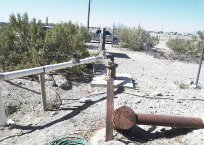
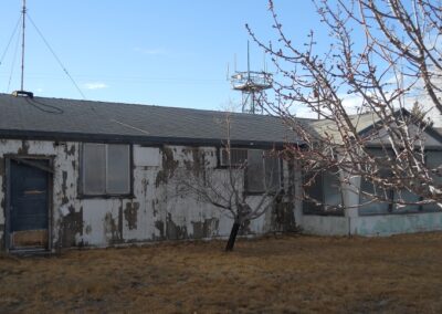
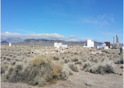
Under the RDSBC project, 25 parcels were assessed in the Pahrump Valley, in Nye County. The assessed properties included two parcels comprising the Mountain Falls Gateway site, which was formerly used for agricultural activities; 19 adjacent and non-adjacent parcels owned by Pahrump Utility Company Inc., which include water and wastewater utility infrastructure; a 0.75 acre portion of a 2,171 acre parcel owned by Nye County for the Tonopah fixed based operations (FBO) building; a parcel for the Nye County Public Works Buildings 1 and 2; a parcel for the Tonopah Library Expansion; and, an a six acre sub-parcel of the Tonopah Airport Parcel 2.